
Walk a Monterey County Street by Address
A Monterey County street directory is assembled from linked records, not opened as one master roster. Begin with the exact street number and name. Confirm the postal spelling and jurisdiction. The County Parcel Report is the spatial bridge. From there, the official Property Inquiry roll can be checked with a parcel identifier, and the Recorder can be used to follow recorded transfers. Directories and voter information add distinct historical or registration clues. Keep each step tied to the same APN and legal description.
- Resolve the address. In the County Parcel Report, use Monterey County Locator's “Find address or place” field, or use “Find Parcel” when an APN is known. Save the APN, formatted APN, legal description, jurisdiction, community, and current recorded-document number. The public GIS map supplies no owner or mailing field.
- Use the official roll. Open Monterey County Property Inquiry and choose Fee Parcel Number or Assessment Number. Enter 12 digits, or a partial identifier of at least six digits, with no punctuation or spaces. Do not expect a name or address search.
- Move to the Recorder. Use the current index for 1978-present or the historical index books for 1850-1977. Match the document number, party name, recording year, document type, and legal description before calling a deed a match.
- Add address history. Check the right permit system for the jurisdiction, then consult Haines or another address-first directory when the edition covers the year. Treat a permit participant or directory entry as a dated clue, not proof of a present household.
- Stop at the lawful boundary. Voter files are not a street browser. Use My Voter Status only for personal verification, and use a county voter-file request only for an approved purpose. Never use a record trail to stalk, harass, intimidate, or harm anyone.
Monterey County Street Directory Coverage
Address-keyed evidence is split among county GIS, the Assessor-County Clerk-Recorder, Monterey Elections, permits, and library collections. Each source answers a different question. A map places a parcel, a roll shows assessment data, and a deed proves a recorded transfer, but none supplies everyone at an address.
| Address-keyed record | Keeper | Street connection | Access and limit |
|---|---|---|---|
| County Parcel Report | Monterey County GIS | Address, APN, legal and district fields | Free map; no owner or mailing field |
| City Engineering GIS | City of Monterey | Address, APN, footprints and layers | Free map; city coverage only |
| Assessment roll | County Assessor | Fee Parcel or Assessment Number | Property Inquiry; no name or address entry |
| Recorder index | Recorder Division | Document number, party and year | 1978-present; historical 1850-1977 books |
| Permit history | Accela or MyMonterey | Parcel, address or community | Unincorporated county versus City of Monterey |
| Voter information | Monterey Elections | Approved geography request | Purpose-limited; no public street browse |
| Reverse directories | Local libraries | Edition and street address | Haines address-first from 1976 |
Together, these records make an evidence chain: APN anchors the map, roll values and ownership fields supply assessment context, document numbers bridge to the Recorder, and permit or directory dates add time-stamped clues. Label results by source, date, and jurisdiction.
Monterey County Parcel Report Maps a Street
The County Parcel Report is the first practical tool for a street-by-street pass. Monterey County Locator offers one autocomplete field, “Find address or place,” with up to six suggestions. The Parcels source has “Find Parcel” and queries APN or APN_FORMAT with a partial match, also up to six results. Select by point, line, extent, circle, polygon, or freehand polygon, then open the Attribute Table or export geography. The layer exposes APN, legal description, subdivision, community, jurisdiction, zoning, hazard, district, and recorded-document fields. Query or selection is limited to 2,000 features.
The Monterey County parcel layer shows the spatial bridge used in a Monterey County street directory.
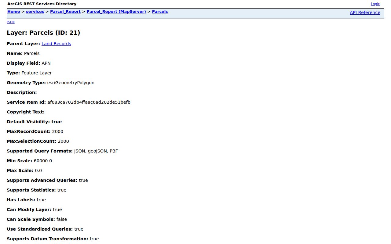
The map helps compare both sides of a street, but it does not turn parcel geometry into a people list. Carry each APN to the official roll one at a time.
Monterey County Street GIS by Jurisdiction
City of Monterey addresses have a separate engineering map. Its Address mode uses a Select Street Name dropdown and an optional Select Address Number. Parcel mode takes a 12-digit APN. Layers cover streets, parcels, footprints, boundaries, historic designations, neighborhoods, coastal areas, contours, hazards, zoning, and general-plan information. Zoom, pan, measure, and map-only PDF tools help test an address before a permit search.
The City of Monterey Engineering GIS is useful for separating a city address from a county or military-area label.
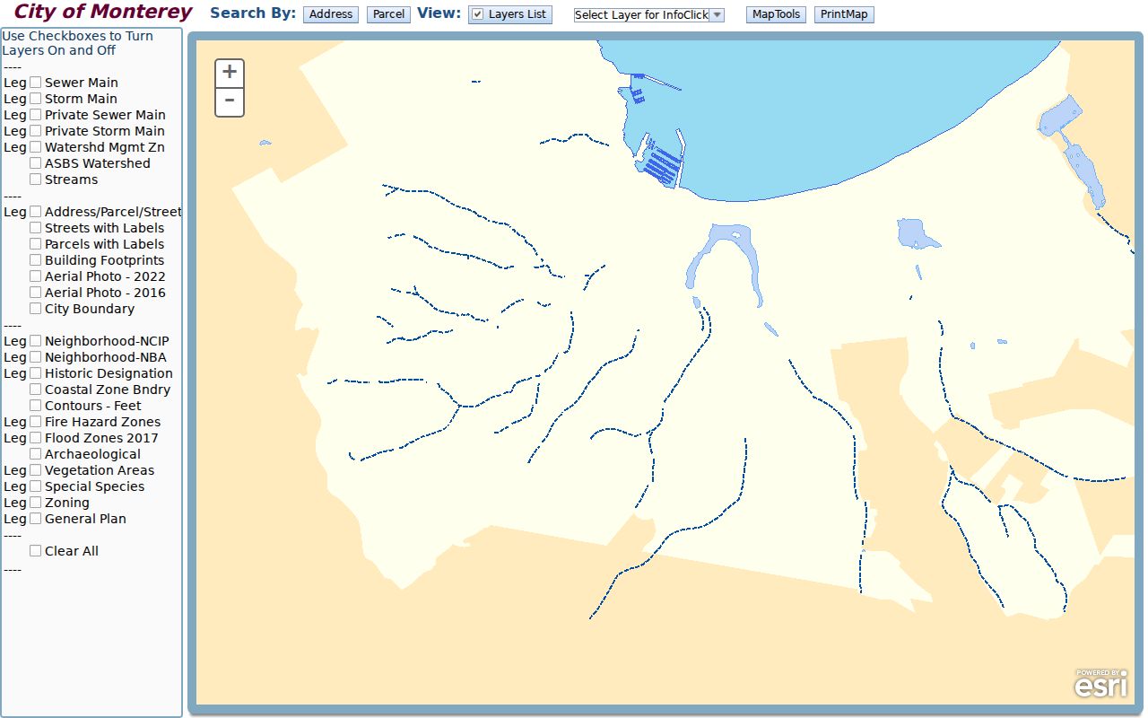
Its coverage is City of Monterey only, and its layers do not create a household list. Confirm jurisdiction before carrying an APN into another office.
Monterey County Street Records Take an APN
Property Inquiry is not a general resident finder. The county's public entry point makes the identifier choice clear, while GIS remains the address-to-parcel bridge.
| Portal | Field or control | Type | Required | Format or result |
|---|---|---|---|---|
| County Parcel Report | Find address or place | Autocomplete | No | Address/place; maximum six suggestions |
| County Parcel Report | Find Parcel | APN search | No | APN or APN_FORMAT partial match; maximum six |
| County Parcel Report | Select and Attribute Table | Map controls | No | Point, line, extent, circle, polygon, freehand; APN/geography output |
| Property Inquiry | Search By | Dropdown | Yes | Fee Parcel Number or Assessment Number |
| Property Inquiry | Parcel/Assessment Number | Text | Yes | 12 digits or partial minimum six; no punctuation or spaces |
| Property Inquiry | Result row | Selection | Returned | Double-click assessment number; Property Information and Roll Values |
The Monterey County Property Inquiry page says owner-name and address searches are unavailable. A valid identifier can lead to ownership, parcel status, tax-rate area, assessed values, exemptions, characteristics, and a conditional Proposition 8 value notice. If the APN is unknown, return to GIS. The assessor is the official roll; GIS is the locator.
Monterey County Street Deeds by Year
The Recorder is the ownership-history step. Current recorded-document service and index cover 1978-present. Separate historical index books cover 1850-1977. Monterey County was one of California's original 1850 counties, so this split reaches from county organization to today. Start with a GIS document number when available. Otherwise, a request needs a document number or reel/page, recording year, at least one party name exactly as indexed, and document type.
Online discovery is only one channel. Research is available at 168 W. Alisal Street, first floor, Salinas, Monday-Friday from 8-noon and 1-5. Mail goes to P.O. Box 29, Salinas, CA 93902. Recorder direct is (831) 755-5041, the peninsula line is (831) 647-7741, and Recorder@countyofmonterey.gov accepts contact. Copies are $2 per page, certification is $2 per document, and maps are $5 per page. The chain runs from grantee to the earlier grantor, then to that party's earlier deed, always matching legal description and APN.
Long record span. Monterey County's 1850-present discovery trail is split between the 1850-1977 historical books and the 1978-present current index.
Situs and Mailing in Monterey County Streets
Address matching fails when postal delivery, land identity, and tax correspondence are treated as one thing. A situs is the physical location of land. A mailing address is where a tax notice or other correspondence is sent. An APN identifies the assessment unit. A legal description can preserve a lot, block, subdivision, or metes-and-bounds identity through a number change.
- Parcel
- An assessment unit shown by an APN and mapped boundaries; one street address can relate to more than one parcel.
- Situs
- The property's physical location, distinct from the address used to receive mail.
- Plat
- A recorded map showing lots, blocks, streets, and boundary relationships.
- Criss-cross directory
- An address-first directory section that points from a street location toward an occupant, business, or phone listing for that edition.
A mailing and situs mismatch can reflect a PO box, trust, office, managed property, or changed data. It suggests nothing certain about present residence. For a street directory, the APN and legal description are a better bridge than a postal label.
Monterey County Permit Records Follow Jurisdiction
Permit research is address-keyed but local. In unincorporated Monterey County, Accela searches without an account by Permit Number, Parcel No., Community, start and end created dates, permit type, and expandable criteria. Results can show record or permit number, type, status, address or parcel, application and issue dates, and public participants. A Community label can include a postal community or ZIP, so it does not prove incorporated-city jurisdiction.
City of Monterey uses MyMonterey to apply for and search city permits, pay fees, upload documents, and track status; first-time transactional users create a profile. The two systems should not be swapped. A permit names an applicant, owner-of-record, or contractor at a point in time, not everyone at an address. When a listed participant is a business, the California Secretary of State explains the available entity fields and copy methods in its business-record information requests.
The unincorporated Monterey County Accela permit search illustrates the county path for a street directory address.
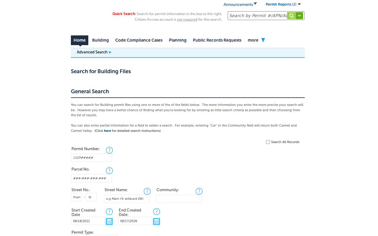
Use the parcel's jurisdiction first: a City of Monterey address belongs in MyMonterey, while an unincorporated address belongs in Accela.
Haines Opens a Monterey County Address Trail
Modern parcel tools do not reach every past household. Early directories are usually name-first, so a known occupant or owner must be found before the street can be checked. Haines changes the direction from 1976. Its reverse or criss-cross format starts with an address and points toward an occupant or telephone listing for that edition. Hill-Donnelly reverse volumes are noted for 1974, 1990, and 2001. Absence can mean a gap, a move, a changed number, or a different publication area.
Check street spelling, number, abbreviations, neighboring entries, and volume scope. Compare the address to APN and legal-description evidence. The historical shelf is developed separately in the Monterey County city directory collections, while the street directory uses those volumes only to add a dated address clue.
New Monterey Street Numbers Need a Bridge
A street directory can fail even when the record exists. New Monterey's late-1930s renumbering kept block hundreds but shifted individual numbers to make room for more occupied lots. Lighthouse Avenue is a named example in the local historic context. A pre-change number and a current number should not be treated as the same address by default.
Compare directory entries immediately before and after the shift. Match cross streets, block hundred, lot or legal description, APN, and Sanborn footprint. Corrected Sanborn sheets also need care because a face date is not automatically a structure date. This bridge protects a past-resident trail from a false break or a false match.
Monterey County Voter Records Are Purpose-Limited
A voter file is not an open street directory. California My Voter Status is an authenticated self-lookup asking for first name, last name, date of birth, and a California driver license or ID number, or last four SSN as the identity check. A match can return registration status, address, party preference, precinct and election information, and ballot-by-mail tracking. It does not show vote choices.
Monterey Elections may review a voter-file request for electoral, scholarly, journalistic, political, or governmental purposes. An approved file may include name, birth date, residence and mailing addresses, party, voter-supplied contact details, and participation history. Driver license or ID, SSN, and signature are not released. Commercial use, solicitation, harassment, and open Internet display are prohibited; Elections Code §18109 makes knowing impermissible access or use a misdemeanor. Safe at Home and confidential voters remain withheld. When the question becomes one named person rather than a whole street, use the Monterey County resident lookup with the same identity checks.
Where a Monterey County Street Directory Stops
A street directory can establish a mapped parcel, an assessment record, a recorded party, a permit event, or a dated directory entry. It cannot establish every person inside a building. Assessor and deed records can omit family members and other household members. A permit applicant may differ from the person at the site. DMV address data is restricted by the federal Driver's Privacy Protection Act. Utility customer lists are not a public resident source. Voter geography is purpose-limited, and Safe at Home or confidential voter records are shielded.
Privacy and lawful use. Monterey County street and address records support personal, lawful research such as genealogy, house history, civic review, and checking a transaction. Do not use an address trail to stalk, harass, intimidate, or harm any person. Verify important facts with the custodian office.
Vital certificates are a separate custodian route. The California vital-record fee schedule and vital-record questions explain copy access; a street map cannot replace an eligible certificate request.
Label every result by source, date, and jurisdiction. A parcel map is spatial, an official roll is assessment evidence, a deed is a recorded transaction, a permit is a project snapshot, and a directory is an edition snapshot. That disciplined chain is the practical meaning of a Monterey County street directory.